NASA’s New 3D Model Shows the Earth Is a Lumpy Mess
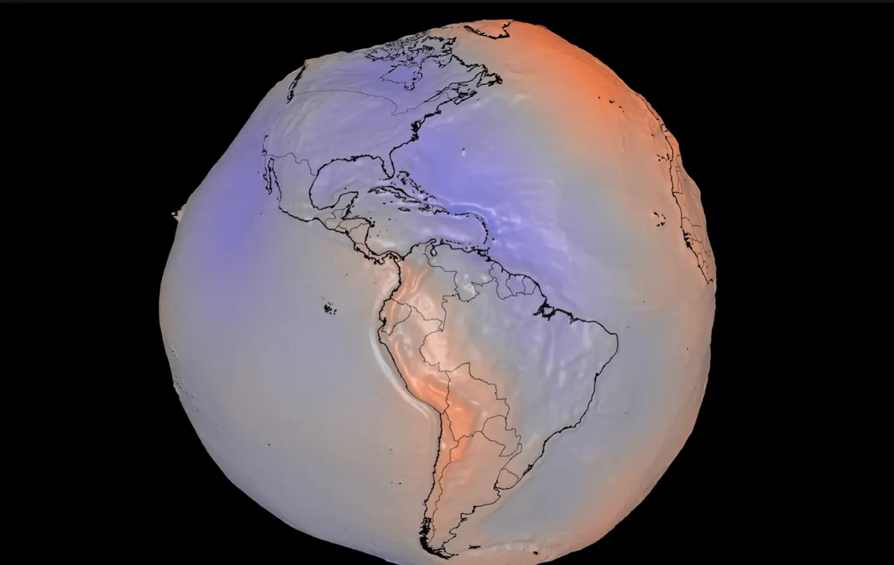
NASA has published a new 3D visualisation of Earth's geoid, revealing the true, irregular shape of the planet's gravitational field rather than the smooth "Blue Marble" image most people recognise. The lumps and dips shown are caused by uneven distribution of mass beneath Earth's surface, and the model represents the surface a global ocean would form if shaped purely by gravity and rotation. Beyond producing a striking image, the underlying gravity data has practical scientific value, helping researchers track ice loss, sea level rise and drought around the world.
The visualisation exaggerates gravitational variations by a factor of 10,000 and was built from 15 years of satellite data comprising a billion observations, with an interactive version also made available by NASA. The same type of gravity measurements, gathered through the NASA-led GRACE mission, show Antarctica losing around 135 gigatons of ice annually and Greenland losing about 264 gigatons a year between 2002 and 2025, data that is crucial for refining sea level rise projections. The observations are also used to monitor groundwater depletion and drought, including the severe dryness currently fuelling wildfires in Spain and France, with soil moisture and shallow groundwater levels in parts of the region near record lows.
- NASA released an exaggerated 3D model of Earth's uneven gravitational field
- Gravity satellite data tracks Antarctic and Greenland ice loss for sea level science
- Same data reveals severe drought behind current Spain and France wildfires