World news and discussion on TalkFuse.
United Nations votes 164-1 for Equal Earth map after US brands it ‘radical ideological project’
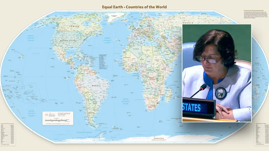
The United Nations General Assembly has voted 164-1 to adopt the Equal Earth map projection, which shows countries and continents in their true relative proportions, meaning Africa appears significantly larger than on traditional maps. The United States cast the sole vote against the resolution, with its deputy representative to the UN Economic and Social Council describing it as a "radical ideological project" masquerading as a technical update, while Togo's foreign minister, who introduced the measure on behalf of the African Group, argued that a fairer map would foster greater understanding and respect between nations.
Six countries, including Ukraine, Georgia and Estonia, abstained from the vote. The resolution targets the long-dominant Mercator projection, devised in 1569 for maritime navigation, which enlarges areas near the poles and shrinks those near the equator, making Africa look far smaller than it actually is relative to places such as Greenland. Although the measure does not compel governments or companies to stop using Mercator-style maps, which remain standard on platforms such as Google Maps owing to their suitability for digital panning and zooming, it formally establishes UN backing for equal-area maps as the preferred way of depicting the world.
In short
- UN adopts Equal Earth map 164-1; only the US voted no
- New map shows Africa's true, much larger size
- US official called it a "radical ideological" push, not neutral cartography
Steelman: both sides, in good faith
The strongest fair case each way — we don't pick a winner.
The case for
Supporters argue that map projections shape how people perceive the world, and that an equal-area projection gives countries a more accurate sense of their relative size. UN endorsement could encourage fairer representation and greater understanding, while leaving room to use other projections where they are more practical.
The case against
Critics argue that choosing a map projection is a technical decision best guided by its intended use, rather than by a claim that one depiction is politically fairer. The Mercator projection remains useful for navigation and digital maps, and UN endorsement of a preferred alternative could be seen as turning a practical choice into an ideological statement.
Explained simply
A map projection turns the curved surface of the Earth into a flat image, and every projection distorts something. The Mercator projection, created in the 16th century to help sailors navigate, preserves direction but makes places nearer the poles look larger than they are relative to places near the equator.
Equal Earth is an equal-area projection, so countries’ relative sizes are shown more accurately, though shapes can look different. The African Group, a group of African countries at the UN, brought the proposal forward; the General Assembly is the UN body where all member states are represented and vote on resolutions.
The resolution gives UN backing to equal-area maps but does not require governments or map services to change what they use. The debate matters because maps shape how people picture the scale and position of countries, while different projections serve different practical purposes.
Africa Americas Art Culture Elections Politics World