Bryson Fire Spreading Near Calamigos Ranch In Malibu, Evacuation Order Issued
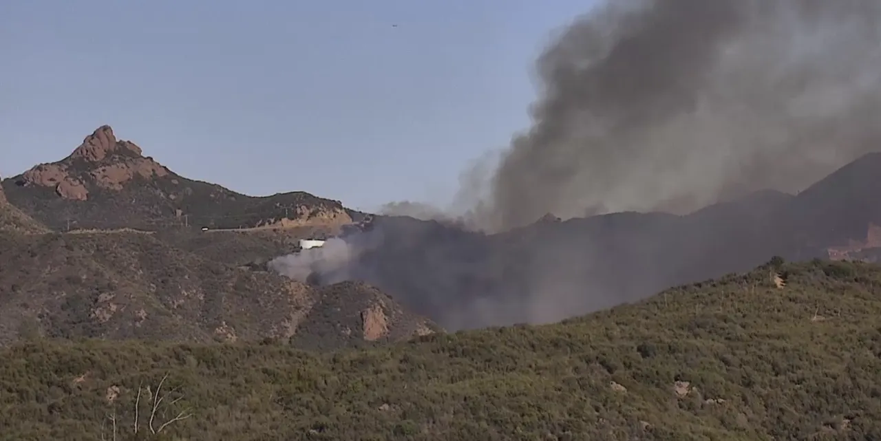
The Bryson Fire spread rapidly through brush in western Malibu, growing from one to about 35 acres in roughly an hour as strong Santa Ana winds drove flames and spot fires. Officials issued an evacuation order for parts of Zuma and Trancas Canyons and warnings for nearby areas, as the fire threatened a sparsely populated landscape where steep hills and canyons can complicate access for crews.
The fire was reported shortly before 5 p.m. near Mulholland Highway and Encinal Canyon Road, close to Camp Kilpatrick and Calamigos Ranch. Winds were around 26 mph, with temperatures at 84°F and humidity at 13%; aircraft and firefighters from Ventura County were dispatched. Winds were expected to ease after dark, but the forecast called for the strongest conditions the following morning if the fire continued.
- Bryson Fire grew to about 35 acres in roughly an hour.
- Evacuation orders covered parts of Zuma and Trancas Canyons.
- Stronger winds were forecast for the next morning.
New here? Start with this
Malibu lies on the coast west of Los Angeles, where homes, ranches and roads sit among dry hills and narrow canyons. In this landscape, a fire can spread quickly through brush, while steep ground and limited routes can make it harder for crews to reach some areas.
Santa Ana winds are dry winds that blow from inland towards Southern California’s coast. They can carry embers ahead of a fire and make flames harder to contain, especially when humidity is low. Local fire crews and aircraft respond to fires in the area, and officials use evacuation orders and warnings to tell people when to leave or be ready to go.