Science news and discussion on TalkFuse.
Nepal’s flood could just be the beginning: Maps reveal the glaciers around the world at risk of a similar disaster – with 15 million people in the danger zone
Developed over time first seen 3 months ago
Scientists say the Nepal–Tibet flash floods were most likely caused by a major rockfall and glacier collapse on Langtang–Lirung, rather than an earthquake or a glacial-lake outburst flood. The event highlights wider concerns that warming mountain regions could make glacier, permafrost and rock failures—and the sudden floods they can trigger—more frequent.
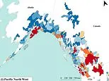
Ice, rock and sediment are thought to have travelled down the valley, temporarily damming the Lhende Khola River before the water burst through. Hundreds of people were reported killed and more than 1,500 missing. Researchers estimate that about 15 million people worldwide live in areas exposed to glacial flooding, with the greatest risk in High Mountain Asia but significant danger also identified in North America, the Alps and the Andes.
- Sources
- 2
- Outlets
- 2
- Left · Centre · Right
- 0 · 1 · 1
In short
- Glacier collapse likely triggered the Nepal–Tibet floods.
- Hundreds died and over 1,500 remained missing.
- Around 15 million people face glacial-flood risks.
How this story developed
- 3 months ago Scientists now say the Nepal–Tibet floods were probably caused by a major rockfall and glacier collapse, rather than an earthquake or a glacial-lake outburst flood.
- 3 months ago Flash floods on the Nepal–Tibet border have killed hundreds of people and left more than 1,500 missing, with early scientific analysis suggesting a landslide and glacier collapse on Langtang–Lirung caused the disaster.
- 3 months ago Scientists say the Nepal–Tibet flash floods were most likely caused by a major rockfall and glacier collapse on Langtang–Lirung, rather than an earthquake or a glacial-lake outburst flood.
Full account
A major flash flood on the Nepal–Tibet border has caused extensive loss of life and destruction along the Trishuli River valley. Officials cited by the BBC said more than 550 people had died and hundreds remained missing, while another report described hundreds killed and more than 1,500 missing. Rescue and recovery operations were continuing as the scale of the damage became clearer.
Early assessments indicate that a collapse involving ice, rock and possibly a landslide on Langtang–Lirung triggered the event. Satellite images and verified footage reviewed by BBC Verify showed a substantial section of glacier missing and a broad scar of debris descending the valley. Scientists quoted in the other report said material may have briefly dammed the Lhende Khola, allowing water to build up before the obstruction failed and sent a destructive surge downstream. The precise sequence will require further investigation.
The flood damaged or swept away settlements, bridges and hydroelectric facilities from the border crossing southwards. BBC imagery identified severe impacts at Timure, Syapru Besi and Trishuli, with mud, boulders and debris covering parts of the valley. It also reported signs of damage upstream of the first struck area, high on the valley sides, illustrating the exceptional force and reach of the flow.
Researchers say such disasters are a growing concern in high mountain regions as warming affects glaciers, permafrost and meltwater lakes. High Mountain Asia is regarded as particularly exposed because it combines rapid warming, expanding glacial lakes and steep terrain. The wider risk is not limited to the Himalaya: assessments cited in the reports identify vulnerable locations in the Alps and North America as well. One estimate puts about 15 million people worldwide in areas potentially exposed to glacial-lake outburst flooding or related cascading hazards.
Where outlets differ
From the full account, which is AI-written from the sources:
The reports give different casualty and missing-person figures: the BBC cites more than 550 deaths and hundreds missing, while the other report gives hundreds dead and more than 1,500 missing.
BBC Verify concentrates on satellite imagery, verified videos and the flood’s route through named communities; the other report focuses more on scientists’ preliminary explanation and the global implications of glacier-related hazards.
The other report characterises the event as a major rock failure involving part of a glacier, whereas the BBC describes it more generally as a glacier collapse; both present the mechanism as an early assessment rather than a final finding.
Centre outlets 1
Only here: satellite, images, scale, devastation, villages
Right-leaning outlets 1
Only here: beginning, maps, glaciers, around, world
Every side used: reveal, flood, nepal
Headline columns compared word for word; nothing in them is AI-written.
Steelman: both sides, in good faith
The strongest fair case each way — we don't pick a winner.
The case for
The case for treating this as an urgent global warning is that a warming climate is destabilising high mountain environments, where melting ice and thawing permafrost can increase the likelihood of rockfalls, ice collapses and sudden flooding. With millions of people living downstream of potentially hazardous glaciers and lakes, advocates argue that governments should invest quickly in monitoring, early-warning systems, land-use planning and climate mitigation, rather than waiting for further disasters to demonstrate known risks.
The case against
The case for caution is that individual mountain disasters have complex local causes, and the reported Nepal event was apparently not a conventional glacial-lake outburst flood. A thoughtful sceptic would argue that global risk maps and population estimates should guide preparedness but not be presented as predictions of imminent catastrophe, since hazard varies greatly by valley, infrastructure and local geology. They may favour targeted, evidence-led adaptation that distinguishes well-established risks from uncertain projections, while avoiding alarm that could misdirect limited resources.
Explained simply
Glaciers are large, slow-moving masses of ice found in high mountain regions. As temperatures rise, ice can melt and unstable rock or frozen ground around glaciers can weaken, increasing the chance of landslides and sudden floods.
Such events can block a river for a short time, creating a temporary dam behind which water builds up. If that blockage fails, the water and debris can rush downhill with little warning, threatening communities, roads and other infrastructure downstream.
Researchers use maps of glaciers, rivers and settlements to identify places where these hazards could affect people. The greatest exposure is in the mountains of Asia, but communities near glaciers in the Andes, the Alps and North America may also face similar risks.
Coverage · 2 sources
Bias meters
From 2 rated sources.