Google Earth risked ruin with retracted AI tool for making fake satellite pics
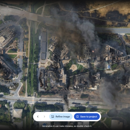
Google briefly introduced an AI feature in Google Earth that let users alter its satellite, aerial and 3D imagery with the Nano Banana 2 image generator, then withdrew it within a day. Critics warned that combining AI edits with a widely trusted mapping and verification tool could make convincing misinformation easier to create and spread, undermining confidence in authentic location imagery.
Google had promoted possible uses such as visualising completed building projects and reconstructing ancient Pompeii, but investigators quickly generated false scenes including refugees near the Mexican border, a nuclear plant in Iran and a fatal crash in Amsterdam. Bellingcat founder Eliot Higgins and investigator Henk van Ess said the tool could reduce a previously multi-step forgery process to seconds; Google initially cited SynthID watermarks on generated images before making the feature inaccessible.
- Google withdrew an AI satellite-image editing feature within a day.
- Researchers warned it could rapidly enable convincing location-based misinformation.
- Google initially relied on SynthID watermarks as a safeguard.