World news and discussion on TalkFuse.
Nearly 50-mile stretch of iconic California highway abruptly closed over flooding threat
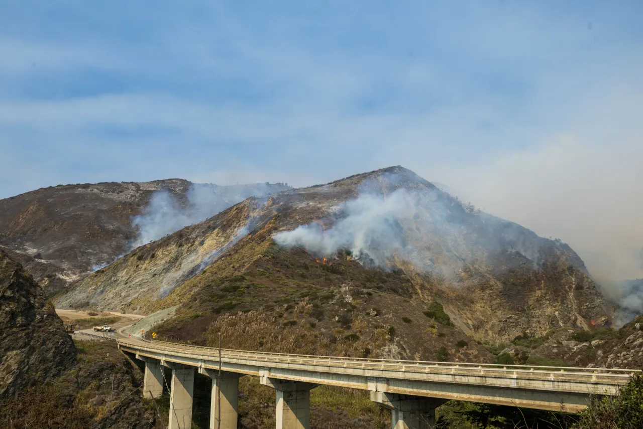
Officials closed a 46-mile stretch of California’s Highway 1 in Big Sur because incoming storms could trigger debris flows across areas burned by recent wildfires. The closure aims to protect motorists from rapidly changing conditions, while crews assess the road and decide when it is safe to reopen.
The closed section runs from Nepenthe to Ragged Point and shut at 1 p.m. Wednesday; Caltrans advised using U.S. 101 as an alternate route. The Timber Fire burned more than 25,300 acres after starting on 8 August, and the Plaskett Fire burned over 30,000 acres from 26 August. Authorities warned that post-fire flows of water, mud, ash, rocks and trees can damage buildings and bury roads, and urged residents to restock essentials and avoid driving once the storm begins.
In short
- A 46-mile stretch of Highway 1 closed over storm-related debris-flow risks.
- The threat involves burn areas from two fires that together burned over 55,300 acres.
- Officials advised motorists to use U.S. 101 and residents to prepare supplies.
Explained simply
Highway 1 follows California’s Pacific coast through Big Sur, a rugged region known for steep cliffs and narrow roads. The road is an important route for people who live in or visit the area, but storms can make parts of it vulnerable to flooding and landslides.
Wildfires can leave hillsides less able to absorb rain, making it easier for water, mud, ash, rocks and trees to rush downhill. These debris flows can block or damage roads and threaten nearby homes, so officials monitor conditions closely after fires.
Caltrans is California’s state transport agency, responsible for maintaining state highways and managing closures. U.S. 101 provides an inland route around parts of Big Sur, although it may add time to a journey.