Super El Niño then and now: NASA releases satellite photos from 1997, 2015 and 2026 to show just how powerful this year’s climate event is shaping up to be
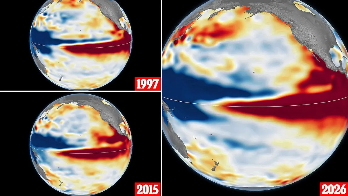
NASA has compared satellite images of the 1997 and 2015 El Niños with the developing 2026 event, which it says has intensified more suddenly than the 1997 episode. The comparison suggests this year’s event could become stronger than either past event, but its eventual effects remain uncertain.
El Niño is a recurring climate pattern in which warmer-than-normal water spreads across the equatorial Pacific, often as trade winds weaken. NASA’s sea-level measurements show the 2026 pattern resembling 1997, with warm water extending towards South America; in 2015, it did not reach as far. The World Meteorological Organisation says Pacific sea-surface temperatures could reach 3.8°C above average from November 2026 to January 2027, compared with the 0.5°C threshold used to declare an El Niño.
In short
- NASA says the 2026 El Niño is building rapidly.
- Satellite images show similarities to the powerful 1997 event.
- Its eventual weather impacts are still uncertain.
Explained simply
El Niño is a recurring pattern in the tropical Pacific, where surface waters become warmer than usual as the trade winds weaken. The warmer water can shift rainfall and weather patterns in different parts of the world.
Scientists track El Niño using measurements such as sea-surface temperature and sea level. The 1997 and 2015 events are useful comparisons, but each event develops differently and does not produce identical effects.
A stronger El Niño can influence temperatures, rainfall and storms, though the effects vary by region and are not certain in advance. The pattern matters because those changes can affect communities, farming and water supplies.
Americas Climate Science Space Technology World